RELIABLE ESRI RESOURCES ASSISTANCE
Based in Phoenix, AZ, EMS is a trusted geospatial services company serving the GIS community for over 25 years.
WE HANDLE THE COMPLICATED TASKS
EMS has been implementing mapping solutions since 1995! Based in Phoenix, Arizona, EMS provides a wide range of consulting services to clients nationwide. We specialize in enterprise-wide GIS consulting, all types of asset conversion, GIS Asset management software integration, and custom web-based data deployment.
COMPREHENSIVE GIS CONSULTING
EMS provides a full range of GIS consulting services. Our role can be as small as providing recommendations on the best approach to your GIS project, to as large as handling the entire design, development, and implementation.
Call us today to start discussing your next geospatial project.
FULL RANGE OF GIS SERVICES
Our full range of GIS services includes needs assessment, system design, implementation, customization, training and technical support to ensure complete and total GIS success. Our highly trained staff stands ready to assist in all aspect of the GIS process including:
Services
- Geodatabase Design and Implementation
- GIS Data Conversion
- GIS Asset Collection
- Custom GIS Application Development
- GIS InfoGraphic Services
- ESRI Implementation Services
- OpenSource Implementation Services
SOFTWARE, RESOURCES & PROFICIENCIES
Software
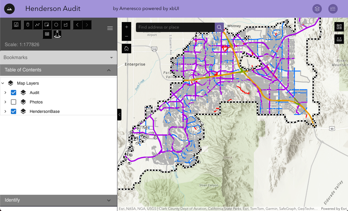
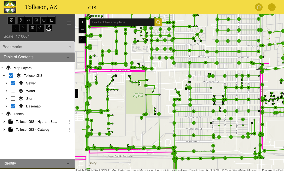
- EMSWebMap - HTML5/Angular JS fully customizable Web-based GIS Viewer
- EMSFieldMap - .NET client-based GIS data viewer
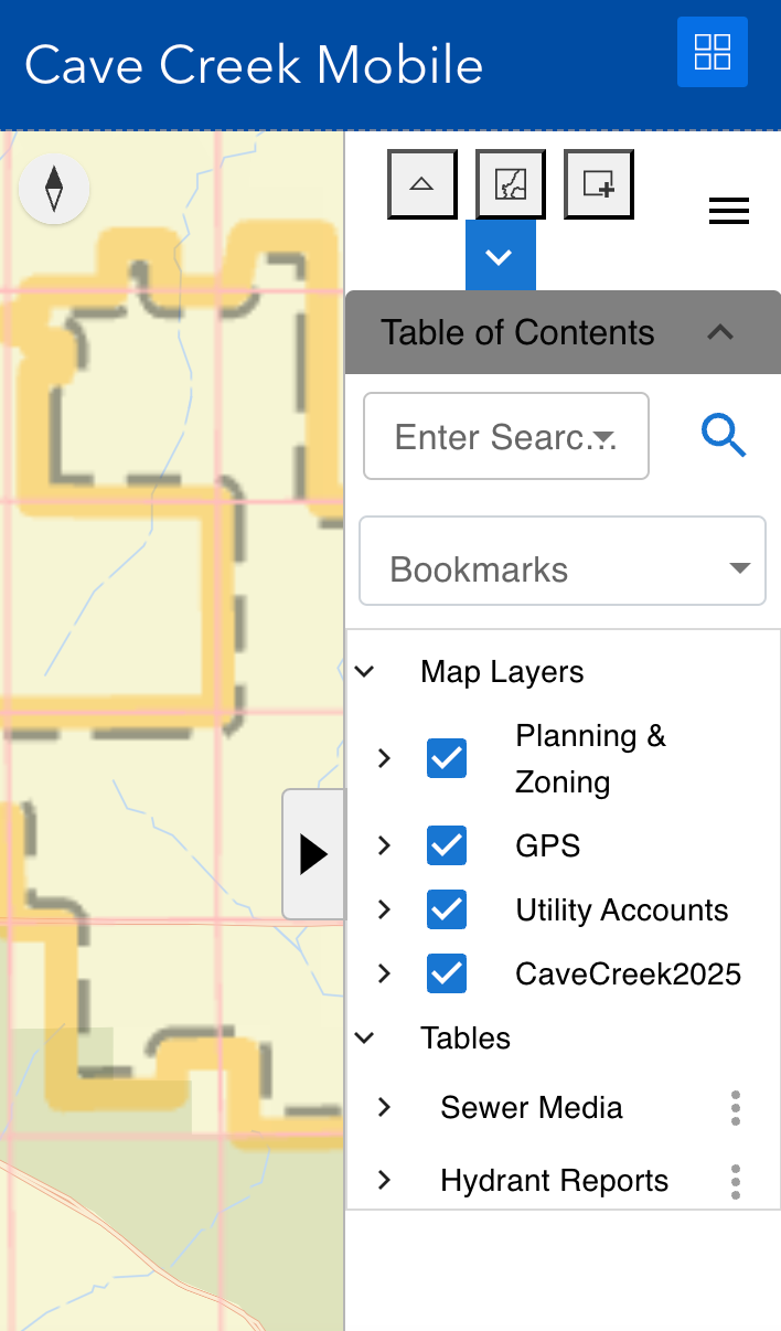
- EMSMobile - Android & iOS-based field data collection
- EMSOpenCloud - GIS Data Hosting
Geospatial Software Resources and Proficiencies
- Esri ArcGIS Desktop Advanced concurrent licenses, v10.5
- Esri ArcGIS Server Workgroup and SQL Server Enterprise, v10.3
- Boundless OpenGeo Suite open source web server and developer SDK, v4.6
- AutoCAD Map 3D (Registered Developer)
- Google AppEngine Developer SDK
- Microsoft SQL Server 2014
- Esri ArcGIS Online Developers Edition, v10.3/li
- Quantum GIS (QGIS) open source Desktop GIS, v2.18
- Google Maps & Bing Maps SDKs and keys
- PostgreSQL/PostGIS v9.4
- Esri JavaScript API, v3.20 (production) and 4.3 (testing mode)
Web Development Environment
- Esri JavaScript API, v3.20 (production) and 4.3 (testing mode)
- AngularJS v1.4 MVC development environment
- Microsoft Visual Studio 602-402-9878 IDE
- Apache Subversion v1.8
- jQuery v2.x, jQuery UI 1.x
- OpenLayers 4.1 (open source JavaScript library for geospatial data)
LEADERS IN GIS SUPPORT
Our customer-centered approach to computer support is what sets us apart from other companies. Your business matters to us, so we will do anything to help get your systems up and running.
SEE HOW
COMPANIES BENEFIT
FROM EMS SOLUTIONS
Arizona Public Service Uses EMSFieldMap in Their Vehicles Across the State of Arizona
EMS customized several modules for their specific searching and display. Originally installed in 2007, APS relies on it to this day.
Infrastructure Management Services Leverages EMSFieldMap for Mobile Data Collection
EMS customized several modules for their specific mobile mapping and collection needs. IMS also uses the EMSOpenCloud web hosting.
City of Alameda, CA CMMS
Web Mapping
Alameda leverages the EMSWebMap Lucity integration to manage their field workorders. EMS created a full GIS system for the City and continues to support and maintain the Enterprise system.
Volusia County, Florida
Mosquito Abatement
Volusia County Mosquito Control leverages EMSFieldMap and EMSWebMap to manage their ground based treatment operations. These custom tools allow the department to define treatment areas, assign personnel, track spray operations live, integrate with their Lucity Work Order Management software, and summarize treatment data for each spray mission.
City of Mesa, Arizona Street Signals
The Mesa Transportation Department utilizes a custom web based inventory and maintenance management system developed by EMS.
City of Surprise, Arizona Permitting Application
EMS developed the Surprise Land Information System (LIS), a web-based application for the Community Development department that covers Development Agreements, Planning and Zoning, Engineering Reviews, Permits, Inspections, and Code Enforcement.
Pocatello, Idaho Enterprise GIS
EMS works with the Town of Pocatello, Idaho to provide GIS and software support for their Lucity Inventory and Work Order Management System.
Liberty Utilities
EMS converted the Liberty Water and Sewer utilities in each of the 13 states it serves across the country. Liberty relies on EMS to host and publish their GIS data to aid in the operations and maintenance of the system.
A Team P.A., Inc. (ATPAI), a Land Surveying Firm, Uses EMSMobile for Field Data Collection
Running in a disconnected mode, field survey information is collected and synced to a cloud server. A TEAM also leverages the EMSOpenCloud hosting for survey research.
Central AZ Water Conservation Distribution - Enterprise GIS
The CAWCD hired EMS to provide a custom application to manage their land leases and encroachments. They are also users of the EMSFieldMap software to view their Enterprise GIS data.
City of Peoria, AZ - Enterprise GIS Data Publishing
As long-time users of both EMSWebMap and EMSFieldMap, the City of Peoria relies on EMS software and support for their Enterprise GIS.
EPCOR Water -
GIS Consulting Support
EPCOR Water relies on EMS for GIS consulting and maintenance. They leverage EMSWebMap to view their Enterprise GIS data.
Research Advisory Services - Redistricting
RAS and EMS teamed to provide the Web-based public interface in the 2015 City of Peoria redistricting effort.

EXPERTISE IN
ESRI RESOURCES ASSISTANCE
The company principals, Martin Shaeffer, P.E. (President) and Phil Ponce, P.E. (Vice President), have over 60 years of combined expertise in engineering design, GIS, CAD, database design, and engineering solutions. Phil Ponce has served as the AGIC Private Sector Representative board member since 2013 and EMS has participated at the yearly AGIC conference every year since 1997.
Now introducing xbSearch and xbChat
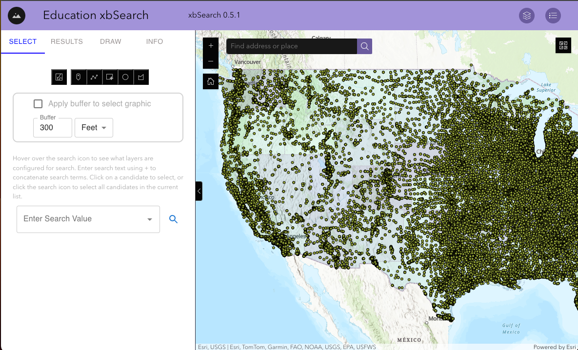
xbSearch
xbSearch is a powerful and versatile tool designed to bring enhanced search functionality to ESRI's Experience Builder platform. As you may know, the previous ESRI platform, WebMap, included The Enhanced Search Widget, developed by Robert Scheitlin. However, Experience Builder, the latest evolution in ESRI's mapping and analysis suite, did not initially offer a similar feature. To bridge this gap and enhance your mapping experience, we developed the xbSearch widget.
Key Features of xbSearch:
•Advanced Search Capabilities: xbSearch replicates the comprehensive search functionality found in WebMap, allowing you to easily locate features and attributes within your maps.
•Draw and View: You can draw directly on the map to highlight areas of interest and view these selections in a tabular format for detailed analysis.
•Select by Graphic: Select features using graphical inputs, such as points, lines, and polygons, to refine your searches and analyses.
•Select and Buffer by Graphic: Enhance your search results by applying buffer zones around your graphical selections, providing a spatial context to your queries.
•User-Friendly Interface: xbSearch integrates seamlessly into the Experience Builder platform, offering an intuitive and accessible user interface for both novice and experienced users.
Whether you are conducting spatial analyses, managing geographic data, or simply exploring your maps, xbSearch provides the tools you need to work more efficiently and effectively. This user guide will walk you through the setup, configuration, and utilization of xbSearch, ensuring you can maximize its potential in your projects.
Click the image to try xbSearch!
xbChat
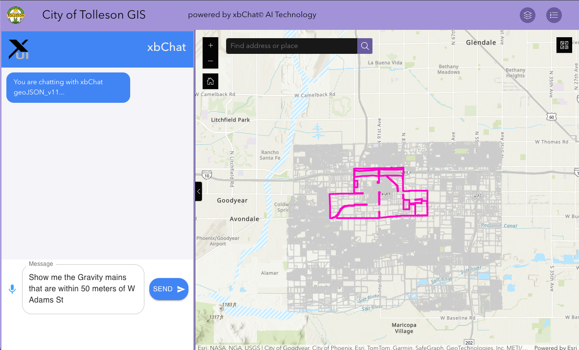
xbChat is a cutting-edge widget designed for Esri's Experience Builder, seamlessly integrating advanced AI technology to enhance your project experience. Whether through typing or voice commands, xbChat offers a powerful and intuitive way to generate search results and obtain relevant information within your Experience Builder projects.
Key Features of xbChat:
- AI-Powered Search: Leverage the power of ChatGPT to conduct comprehensive searches directly within your Experience Builder projects, ensuring you get the most accurate and relevant results.
- Voice and Text Functionality: Interact with xbChat using either text input or voice commands, providing flexibility and convenience for users with different preferences.
- Seamless Integration: Easily integrate xbChat into your existing Experience Builder projects, enhancing their functionality without disrupting your workflow.
- Real-Time Responses: Get instant search results and responses, enabling you to make informed decisions quickly and efficiently.
- Customization Options: Tailor xbChat to fit the specific needs of your project, with customizable settings that allow you to adjust its functionality and appearance.
- Enhanced Productivity: By automating the search process and providing quick access to information, xbChat helps boost your productivity and streamline project development.
Experience the future of intelligent search with xbChat, and transform the way you interact with Esri's Experience Builder projects.
Click the image to try xbChat!
New

